


More of Don's
photo series.
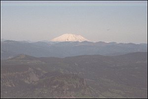
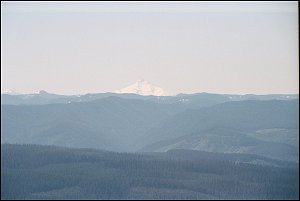
Mount St. Helens from Larch Mountain. Larch Mountain isn't exactly in the Columbia Gorge, but you get there by taking a road off the Historic Columbia River Highway, then a short trail (short, but with 121 steps to climb). From the lookout you can see the five [actually nine; see below] snow-capped volcanoes shown here. Looking across the Gorge, you can see Mount St. Helens, which is 46 miles to the northwest, and is 8,363 feet tall. . .
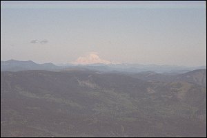
. . . and, going clockwise, Mount Rainier, loftiest of the Cascade peaks, approximately 100 miles to the north, slightly east, and 14,410 feet tall.
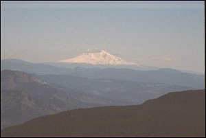
Next comes Mount Adams, 54 miles to the northeast, and 12,307 feet tall.
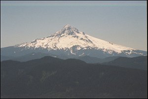
Mount Hood, the tallest mountain in Oregon at 11,235 feet in elevation, lies 22 miles to the south. In this direction we overlook Bull Run, Portland's watershed.
Mount Jefferson, Oregon's second highest Cascade volcano, lies 62 miles to the south, slightly west, and is 10,497 feet high. If you look at the extreme left side of the photo, you can see a group of mountains, the Three Sisters, about 100 miles away, slightly to the east. Also in that group is Broken Top, which makes nine snow-capped peaks visible from Larch Mountain (visible, but not all are distinguishable). It could be that Mt. Washington is visible there also. Hard to tell.
Better photos are still to come, I hope, the next clear day I can get to Larch Mountain. The road is blocked by snow about six months of the year.
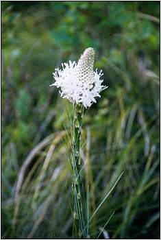
Seen on the Sherrard Point Trail in June.
Northwest Forest Pass required to park
in the Larch Mountain parking area
(obtainable at the parking lot for $5).
Previous Index Next
©D.L. Mark 1999-2007