


More of Don's
photo series.
and Shastina
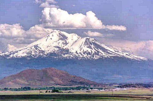
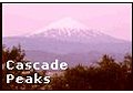
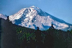
Mount Shasta, in northern California, is the second highest Cascade peak, at 14,162 feet. It is snowcapped throughout the year, although some summers the snowcap is severely diminished.
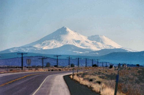
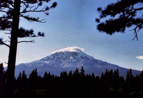
Mount Shasta presents a different aspect as you look at it from different directions, moreso than most mountains, I think. The photo above is from about 30 miles NNW, the one below from maybe 40-50 miles NNE, on US 97 just north of the California-Oregon border. The lower peak is Shastina, sometimes considered to be a separate mountain. Shastina's elevation is 12,330', which makes it the third highest Cascade peak, after Rainier and Shasta itself.
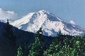
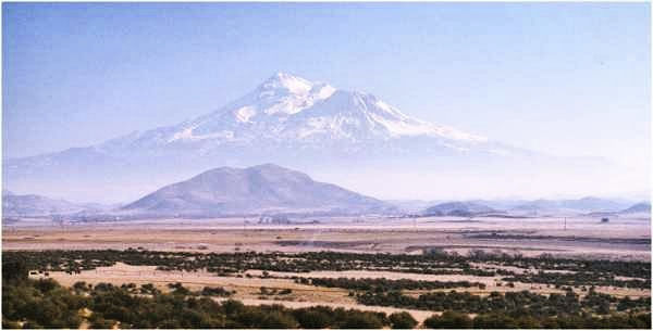
Below you can see the difference in snow cap from June to September. These shots are from about 22 miles south of the mountain.
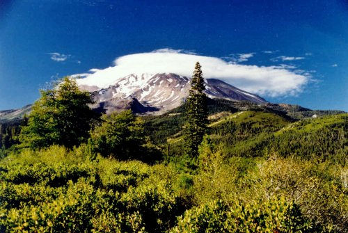
Approaching Mount Shasta from the southeast, I see it has a cloudcap! I have never seen a cloudcap before, but it is a hazy day and I can't get a very good shot of it. As I get closer to the mountain, the air clears and the cloudcap becomes more distinct. Very impressive. These shots were taken toward the end of August; you can see how diminished the snow cover has become. Soon, with the coming of winter, it will be replenished.
The Shasta Indians and many other people believe Mount Shasta has mysterious spiritual powers.Mount Shasta, an active volcano, may have erupted in 1786; it has not erupted since then, at any rate. There are, however, hot sulphur springs near the summit.
Where the name Shasta comes from is a conundrum. Peter Skene Ogden is often credited with naming it; however, the mountain he named "Shastise" or "Shasty" is most likely Mount McLoughlin.
Mount Shasta was referred to on early maps as Pit Mountain, Mount Simpson, Mount Jackson, Snowy Butte, Sasty Peak, and Mount Tsashtl. Various Indian tribes used the names Melaikshi, Wahkalu, Bohem Puyok, and Yet.
Highway 97 runs close by Mount Shasta on the north and northwest. This is the Alaska Highway: it starts at Weed, California, and goes right on north through Oregon, Washington, British Columbia, and Yukon to Anchorage, Alaska—one of the great highways of the world.
The California and Oregon sections as far north as Madras, Oregon, are flat, smooth, wide, and beautiful. Unfortunately, these sections have seven big problems: fog, deer, towns, trucks, flatness to the point that you cannot always see oncoming cars, ice (in winter), and diligent patrolmen.
From Madras, Oregon, to Ellensburg, Washington, 97 takes the high road. It is mountains all the way, with wide and lovely vistas. At a couple of places there are turnoffs with a "mountain identifier" which points out all the snowcapped peaks you can see.
Between Yakima and Ellensburg you come to a rest area which has a spectacular view of Mt. Adams and Mt. Rainier.
I'll tell you more about the rest of US 97 at some other time. There's a little more here.
Mount Shasta from about thirty miles NNW.
©D.L. Mark 1997