


More of Don's
photo series.
Mount Rainier
and Little Tahoma
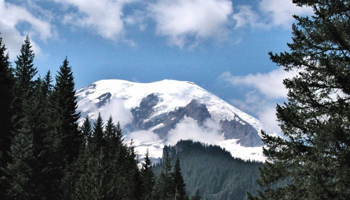
The Indian name of the mountain is "Tahoma" or "Tacoma"; "Rainier" comes from a sailor on some ship or other. I feel that "Tacoma" is a more worthy name.
From 1941 until 1947 I lived where I could see Mount Rainier, at least when the weather allowed—it was an inspiring sight. That was from the northwest. The first time I saw it, it was from the northeast: it looked like a scoop of ice cream.
In those days, the maps and geography books said Mount Rainier was 14,408 feet high. I don't know if the mountain has grown 2 feet in elevation, or if measurements are just more accurate now.
Here's the answer to that one:
"Apparently, there's something pretty solid under that ice cap."
Rainier stands 14,411.05 feet high, 12.6 inches taller than altitude figured in 1956
TACOMA (AP)-The results are in from the most high-tech measurement of Mount Rainier.
Using data from a constellation of satellites and the number-crunching power of modern computers, Bothell surveyor Larry Signani calculated the mountain's height at 14,411.05 feetjust 12.6 inches taller than the official height computed in 1956 by the U.S. Geological Survey, using traditional triangulation methods.
The new measurement is even closer to the 14,411.1 feet logged in 1988 by many of the same people involved in this latest effort.
"It's amazing it came up that close to what we had 11 years ago," said Signani, who organized the remeasurement to commemorate this year's centennial celebration for Mount Rainier National Park.
"Apparently there's something pretty solid under that ice cap, because it doesn't seem to be fluctuating very much."
Global positioning
The new measurement was made using Global Positioning System, or GPS, data, which surveyors can now use to pinpoint elevations with unprecedented accuracy.
In late August, a team of six surveyors climbed the summit carrying two lightweight GPS receivers, which detect electronic signals from 24 GPS satellites orbiting the earth.
Measurements are calculated by timing how long it takes the satellite signals to reach the receiver and by doing a lot of mathematical gyrations.
Mount Everest
Similar measurements made on Mount Everest in May yielded a height of 29,035 feet for the world's highest peak7 feet taller than the old measurement.
The Mount Rainier measurement, if certified and adopted, would confirm the mountain as the fifth tallest in the contiguous United States, after California's Mount Whitney and three peaks in the Colorado Rockies. "The nation's tallest peak is Mount McKinley in Alaska, recorded officially at 20,320 feet.
Signani is determined to at least try to get the latest Mount Rainier measurement adopted by federal officialssomething he and his colleagues neglected to do after they became the first to use GPS to measure a mountain's height in 1988. The figure they came up with on that occasion does appear on some National Park Service and state maps, but was never made official.
If the new height is certified and adopted, it can be used when the
next batch of Mount Rainier maps is printed, said Dale Benson, supervisory cartographer at the US Geological Survey's mapping division in Denver.
It can also serve as a baseline for measuring any swelling of the
mountain that may occur when the volcano awakens, as geologists agree it will some day, said Eugene Iwatsubo of the survey's Cascades Volcano Observatory in Vancouver.
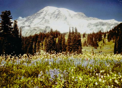
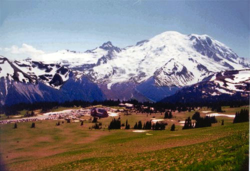
The view from Paradise and Sunrise. Paradise is on the southern slopes of the mountain; Sunrise is on the eastern slopes.The peak to the left of Rainier in the Sunrise photo is Little Tahoma, which is often considered to be a separate mountain. The clear sky in the photos is not too common; usually it's cloudy.
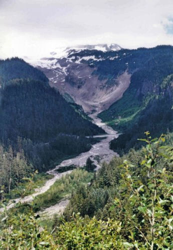
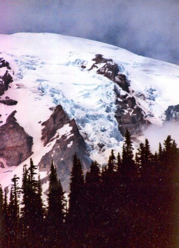
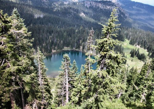
The top photo of these three is of a glacier-carved valley. Glacier-carved valleys are usually U-shaped, as this one is. The glacier which carved the valley is hidden by the clouds, but the middle photo shows a different glacier, right in the center of the photo. Glaciers are rough (in contrast to the surrounding snow fields) and bluish. The lower photo shows a lake of glacial origin visible from Sunrise Point. The lake is named—surprise, surprise—Sunrise Lake.
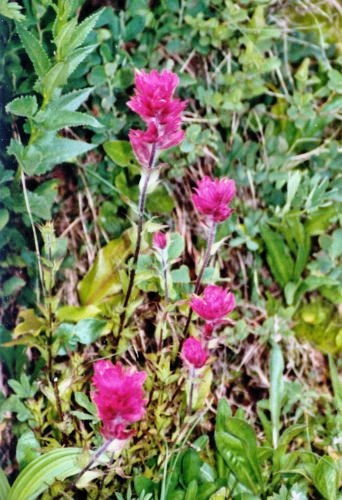
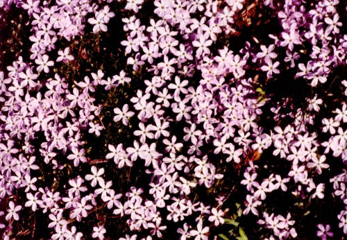
Mount Rainier is noted for its wildflowers growing right next to snow. The flower in the upper photo is called Indian paintbrush; the ones on the lower photo are called little purple flowers.
Will Mount Rainier erupt? "In western Washington, geologists from the Cascades Volcano Observatory [keep] watch on Mount Rainier, 50 miles southeast of Seattle—says Kevin Scott, a U.S. Geological Survey hydrologist, 'the most dangerous volcano in the whole United States.' The danger is not that the mountain will blow up—Rainier's history suggests that any new eruption would probably be fairly gentle—but that it will unleash a cataclysmic flash flood of mud, rock and ice known as a lahar. On its upper slopes, Rainier is covered in thick glaciers; inside, it is rotten with hollows carved by flowing magma and sulfuric acid, creating an unstable situation that could be disrupted by even a minor earthquake. It has happened at least 55 times over the last 10,000 years. Evidence of the last big flow, some 500 years ago, is easy to find; passing a man-made pond near a development within easy sight of Rainier, Scott points out what looks like a stump. 'That's the top of a tree,' he says. 'The rest of it is buried in 30 feet of mud.'
"Geologists have calculated the likely flows of a lahar off Rainier's slopes and found that several paths head straight for the city of Orting, a burgeoning outpost (population 3,000) of the Seattle-Tacoma metropolis. Situated 30 miles down a narrow valley from the summit, Orting would be reached by a lahar in an hour or less and buried within minutes. The town has an evacuation plan, but the fallacy, Scott says, is the assumption that anyone would be in a position to sound the alarm. There are seismographs on Ranier, but only an expert geologist could tell if a lahar was on its way. And when the geologists go home at the end of the day, nobody is watching." (© Newsweek, May 5, 1997, p. 67-68.)
Mount Rainier, at 14,411 feet, is the loftiest of the Cascade peaks. It is located southeast of Seattle and/or Tacoma.
State-of-art peak measurement close to old one
LARRY SIGNANI, surveyor
--From the November 18, 1999, Columbian, Vancouver, Washington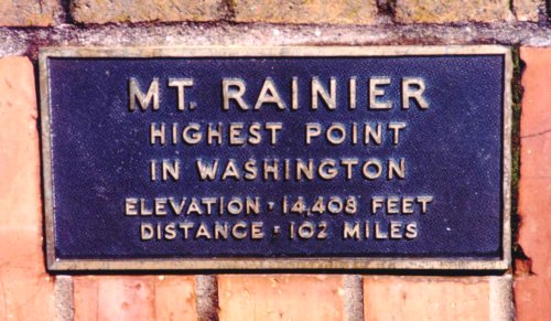
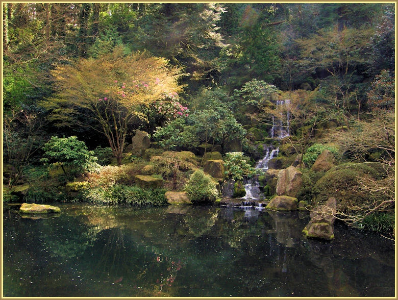
This sign on the viewpoint at Council Crest, in Portland, Oregon, was installed many years ago. It proves my point, in case there were any doubters.
©D.L. Mark 1997
Cascade Peaks Navigation: Cascade Peaks Index | Next Lower | Special Cases